
Yesterday I went back down to Kitengela again for another visit; although Joseph had been able to give me a good introduction to the town and the problems it has been facing, the range of our exploration was limited due the fact that we didn’t have a car.
 Luckily, David, my ILRI counterpart who is based in Kitengela, was free yesterday and had one of the ILRI 4-wheel drive Suzukis for the day.
 I’m glad that I went back; we spent the afternoon driving around the pasture land, traveling primarily by traversing unpaved jeep tracks that connect the two main tarmack roads, which lie about 15 km apart. In the course of the afternoon, we encountered numerous large herds of cattle, which David remarked looked remarkably healthy, given that the entire area had been suffering from a severe drought in the first few months of this year.
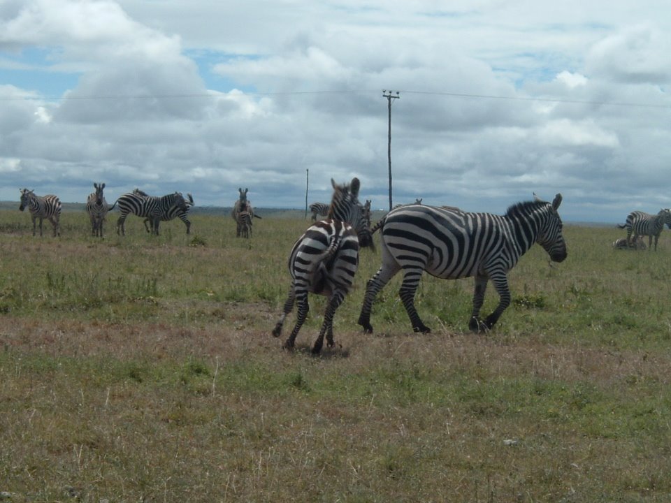 In addition, to the numerous cattle and small stock, there were TONS of wildlife, in many cases coexisting in close proximity to the livestock. In the 3 hour drive I saw probably close to a hundred zebras, lots of Thompson’s and Grant’s Gazelles (which David and Joseph could identify and differentiate at about 300 or 400 meters), a large group of vervet monkeys, and a few wildebeest. Where was also more birdlife than I could identify, most notably a large pack (Troop? Clatch? Murder?) of Ostriches, and my two favorite punnable birds, (victoria’s) Egret and the (old dirty) Bustard. OMG I AM HILLARIOUS…HAHAHAHAHAHAHAHAHAHA.
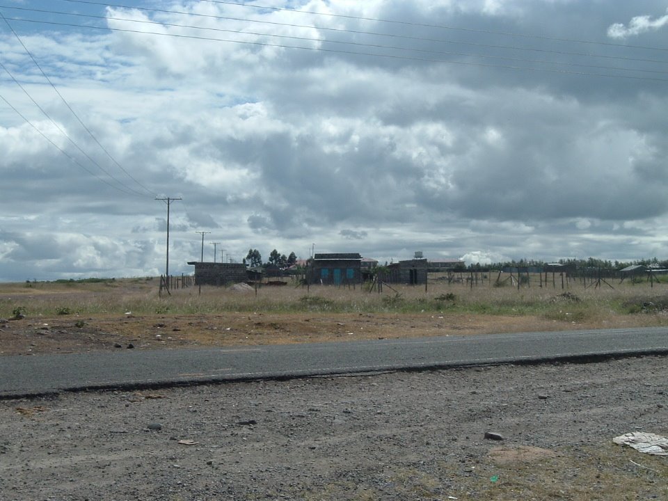
 Indeed, seeing the splendor of the countryside that begins just a kilometer outside of the town center confirms why the uncontrolled expansion of Kitengela that I was describing the other day is such a big problem. Close to town, there are not yet many houses built, but many of the plots have been subdivided and fenced off into tiny plots of about 1/8 of an acre.
 What is fascinating is that according to David, these plots aren’t usually developed after they’ve been marked off; for reasons that I don’t precisely understand, the exclusive right to own land has become an end in and of itself, rather than a means to anything else (most notably agricultural investment- but hey, even commercial or industrial development would be productive in some way). While one tiny, fenced off patch of land, might seem like a trivial island in an ocean of forage, the aggregate effect of these many small fenced areas is to severely restrict the usual patterns of both wildlife and pastoral migration. When the wild animals have problems with the fences they often run into them, often getting tangled, or maybe toppling them if they are in a large, fast-moving herd; when cattle-herders come across the fences. they are quite likely to cut the wire of the fence and let their cattle feed in the plot. This outcome is especially likely in cases such as the recent drought when the existence of a patch of fresh grass in a sea of over-grazed burnt out scrub is particularly difficult for pastoralists to accept.
If you’ve been following my adventures semi-closely, you might remember that my last post about Kitengela ended on a bit of a downer (or if you’re an optimist, I guess you could say that it was “open ended”); I posed the problem that the rapid in-migration to Kitengela has lead to a crisis of governance, without offering anything by way of a solution. What I learned yesterday is that an institutional solution is currently in the process of being hammered out, largely due to the initiative of the Kitengela Landowners Association, of which David is one of the leaders.
 In fact, the reason that David wasn’t free to show me around on Wednesday when I was in town was that he was in meetings with the local government, the Kenya Wildlife Service, and the national Minstry of Land to develop a plan for the use of land in Kitengela over the next 10-20 years. The central achievement of this plan is that it secured an agreement from the government to create a firm boundary for development; essentially drawining a firm line, beyond which all land will be used primarily for extensive grazing. An additional feature of the agreement would be to provide incentives for fence-less demarcation of land, essentially disaggregating the property rights, allowing open access for through traffic, but keeping rights of cultivation and usufruct under the exclusive control of the title holder.
 This agreement is unprecedented; according to David and Joseph, this is the first such case of the government taking steps to develop a long-range land use and development plan. Because of Kitengela’s unique proximity both to Nairobi and to the National Park, is is thus well situated to be a laboratory for institutional design. That said, many questions remain; with respect to both of the main features of the plan (the sprawl line and the fenceless plots), enforcement and the credibility of commitments seems to be a potential problem. For instance, the enforcement of the “sprawl boundary” is largely in the hands of the county government, which has the authority to approve and deny building projects -what is going to prevent local government from abrogating the agreement and allowing development? I could imagine that well placed bribes from would-be developers could change the current resolve of some officials- in order to prevent this, there needs to be a way for the broader community to hold these policy makers accountable. What I’m getting at here is not only the point that institutional design matters, but that institutions work in bundles, and ulitimately are sustainable only if they provide incentives for the various stakeholders to enforce the rules. Thus, while what is happening right now in Kitengela is exciting and offers lots of hope, the long-run prospects are still rather open-ended, if I might say so myself.
No comments:
Post a Comment